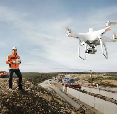
Drone Surveying
Transform your project with accurate, fast, and cost-effective drone surveying services. We provide high-resolution aerial data collection and advanced geospatial products for construction, mining, infrastructure, agriculture, and land development projects.
Deliverables
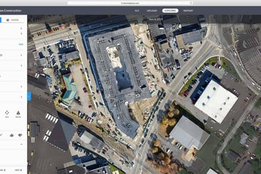
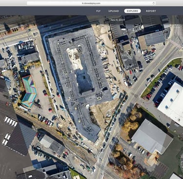
✔ Orthomosaic Maps (2 cm–5 cm GSD)
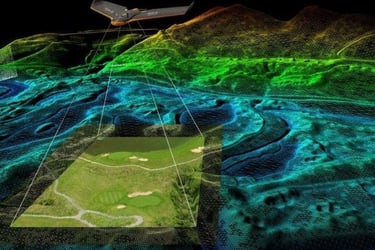
✔ Digital Terrain Models (DTM)
✔ Digital Surface Models (DSM)
✔ Contour Maps (0.25m, 0.5m, 1m Intervals)
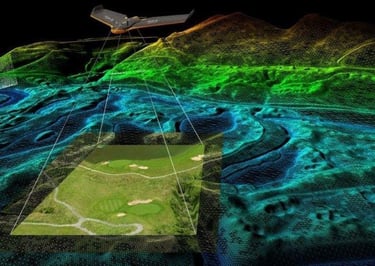
✔ 3D Point Clouds
✔ CAD Drawings (DWG/DXF)
✔ GIS Ready Data (Shapefile, GeoJSON)
✔ Volume & Stockpile Reports
Our Services
Drone Land Surveying
Topographic Surveys
Boundary Mapping
Site Development Surveys
Construction Progress Monitoring
Volume Calculations
Cut & Fill Analysis
Photogrammetry Processing
Orthomosaic Generation
Digital Surface Model (DSM)
Digital Terrain Model (DTM)
Contour Map Creation
3D Point Cloud Generation
3D Mesh Modeling
LiDAR Surveying
Dense Point Cloud Generation
Vegetation Penetration Analysis
Utility Corridor Mapping
Powerline Inspection
Forest Inventory Mapping

Precision from orbit to office.
01 / Acquisition
02 / Calibration
03 / Integration
Our autonomous drone fleets capture high-resolution aerial telemetry and LiDAR scans under optimal, high-contrast daylight conditions.
We rigorously ground-truth every pixel of raw data against established physical benchmarks to achieve absolute, sub-centimeter coordinate alignment.
Fully structured spatial intelligence is delivered directly into your existing CAD and GIS workflows for immediate engineering use.
Ready to ground-truth your next project?
Connect directly with our engineering directors to scope your precise aerial surveying parameters and telemetry integration requirements.